
Anúncios
Google Maps has revolutionized the way we navigate the world, offering precise GPS tracking, real-time route planning, and accurate estimated arrival times for every journey.


Whether you’re commuting to work, exploring a new city, or embarking on a cross-country road trip, having a reliable navigation tool is essential. Google Maps combines satellite imagery, street-level views, and crowd-sourced traffic data to ensure you reach your destination efficiently.
Anúncios
The beauty of modern GPS technology lies in its ability to adapt. When unexpected roadblocks appear or traffic conditions change, your route adjusts instantly. This dynamic functionality transforms stress into confidence, making every journey smoother and more predictable.
🗺️ How Google Maps GPS Transforms Your Travel Experience
Google Maps isn’t just a digital map—it’s a comprehensive travel companion that understands your needs. The GPS functionality tracks your exact position in real-time, updating your location every few seconds to ensure pinpoint accuracy.
Anúncios
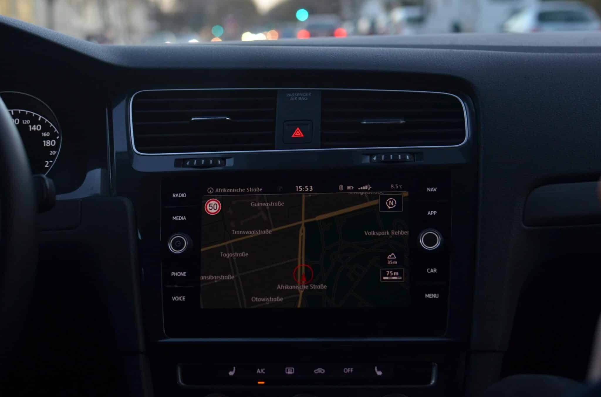
The interface displays your current location as a blue dot, with a light blue circle indicating the precision range. This visual representation helps you understand exactly where you are, even in dense urban environments with tall buildings that might affect satellite signals.
What sets Google Maps apart is its integration of multiple data sources. The app analyzes historical traffic patterns, current road conditions, accidents, construction zones, and even weather conditions to provide the most efficient route possible.
Real-Time Traffic Analysis
One of the most powerful features is the live traffic overlay. Color-coded roads show you exactly what to expect:
- Green lines: Traffic is flowing smoothly at or near the speed limit
- Orange/Yellow lines: Moderate traffic with slower speeds
- Red lines: Heavy congestion with significant delays
- Dark red lines: Severe traffic jams or stopped traffic
This visual system lets you make informed decisions before you even start driving. If your usual route shows red, you can explore alternatives with a single tap.
📍 Tracing Your Route with Precision
Planning your route on Google Maps is incredibly intuitive. Simply enter your destination, and the app calculates multiple route options, each with estimated travel times and distance information.
The route comparison feature displays up to three different paths simultaneously, allowing you to choose based on your priorities—whether that’s shortest distance, fastest time, or avoiding tolls and highways.
Each route suggestion includes detailed information about the journey ahead. You’ll see the total distance, estimated duration, and any notable features like toll roads, ferries, or highway vs. local road preferences.
Customizing Your Navigation Preferences
Google Maps offers extensive customization options to match your travel style:
- Avoid tolls, highways, or ferries based on your preferences
- Choose between driving, walking, cycling, or public transportation modes
- Set departure or arrival times to see traffic predictions
- Save favorite locations for quick access
- Add multiple stops along your route for complex trips
The multi-stop feature is particularly useful for errands or business routes. Add up to nine additional destinations, and Google Maps optimizes the order to save time and fuel.

⚠️ Navigating Around Unexpected Obstacles
Life rarely goes exactly as planned, and the same applies to road travel. Construction zones appear overnight, accidents cause sudden delays, and weather conditions can make certain routes dangerous.
Google Maps excels at handling these surprises. The app continuously monitors conditions along your route and proactively suggests alternatives when problems arise. You’ll receive notifications about incidents ahead, giving you time to make decisions rather than discovering blockages at the last moment.
Automatic Rerouting Technology
When you’re actively navigating, Google Maps watches for disruptions that could affect your journey. If faster routes become available due to clearing traffic or if your current path encounters new delays, the app offers updated options.
The rerouting happens seamlessly. A notification appears showing the time savings of the new route, and you can accept the change with a single tap or ignore it if you prefer your current path.
This dynamic adaptation means you’re never locked into a poor choice. The app learns and adjusts continuously, treating navigation as an ongoing optimization problem rather than a fixed solution.
Crowdsourced Incident Reports
Millions of Google Maps users contribute real-time information about road conditions. Through integration with Waze data and user reports, you gain access to incredibly current information:
- Accident locations and severity
- Police presence and speed traps
- Road closures and construction zones
- Disabled vehicles blocking lanes
- Objects on the roadway
This crowdsourced intelligence transforms Google Maps from a passive tool into an active community resource, with everyone contributing to safer, more efficient travel for all users.
⏰ Accurate Time Predictions for Every Journey
Understanding exactly when you’ll arrive is crucial for planning your day. Google Maps provides remarkably accurate time estimates by analyzing multiple factors simultaneously.
The prediction algorithm considers your current location, distance to destination, speed limits along the route, current traffic conditions, historical traffic patterns for that time of day, and typical delays at intersections and traffic signals.
What makes these predictions impressive is their accuracy. Studies have shown that Google Maps time estimates are typically within a few minutes of actual arrival times, even for long journeys across multiple cities.
Time-Based Route Planning
You can plan routes based on specific times rather than just “now.” This feature is invaluable for scheduling:
- Setting a departure time to see predicted conditions when you’ll actually leave
- Setting an arrival time to determine when you need to depart
- Comparing travel times across different parts of the day
- Avoiding rush hour by visualizing traffic patterns
For example, if you need to arrive at a meeting at 9:00 AM, enter that as your arrival time. Google Maps calculates backwards, showing you exactly when to leave based on predicted traffic conditions at different departure times.
Live Updates During Navigation
Once you start your journey, the estimated arrival time updates continuously. As you encounter traffic, make stops, or travel faster than expected, the prediction adjusts accordingly.
The app displays your current speed, distance remaining, and updated arrival time prominently on screen. This real-time feedback helps you understand whether you’re on schedule or need to communicate delays to people waiting for you.
🚗 Enhanced Features for Drivers
Google Maps includes numerous features specifically designed for drivers, making the navigation experience safer and more convenient.
Voice-guided turn-by-turn directions mean you never need to take your eyes off the road. The app announces upcoming turns, lane guidance, and important information audibly, allowing you to focus on driving safely.
Lane Guidance and Exit Information
Complex highway interchanges become manageable with visual lane guidance. The app shows exactly which lane you should be in for your upcoming turn or exit, preventing last-minute dangerous lane changes.
Exit numbers, road names, and distance countdowns appear clearly, giving you plenty of warning to position your vehicle correctly. This feature is especially valuable when driving in unfamiliar areas with complicated road systems.
Speed Limit Display
Many regions now show posted speed limits directly on the navigation screen. This subtle but valuable feature helps you stay legal and safe, particularly on roads where limits change frequently.
Some versions also include speedometer functionality, showing your current speed alongside the limit for easy comparison without checking your vehicle’s speedometer.
Parking Assistance
Finding parking can be as stressful as the drive itself. Google Maps addresses this with parking difficulty indicators near your destination, showing whether parking is typically easy, medium, or difficult to find.
The app also displays parking lot locations, parking garages, and even parking rates where data is available. This information helps you plan extra time for parking or consider alternative transportation for the final leg of your journey.
📱 Offline Navigation Capabilities
Not every journey keeps you connected. Remote areas, international travel without data plans, or simple desire to conserve battery life make offline maps essential.
Google Maps allows you to download map regions for offline use. These downloaded areas include full navigation capabilities, business information, and points of interest—all without requiring an active internet connection.
Downloading Maps for Offline Use
The download process is straightforward. Search for a location or region, access the menu, and select “Download offline map.” You can customize the area size to balance detail against storage space on your device.
Downloaded maps update automatically when you’re connected to Wi-Fi, ensuring your offline navigation remains current with road changes and new businesses.
This feature transforms Google Maps into a truly universal navigation tool, reliable whether you’re exploring rural backcountry or traveling internationally without expensive roaming charges.
🌍 Multi-Modal Transportation Options
While driving receives significant attention, Google Maps excels at planning trips across multiple transportation modes, creating truly comprehensive journey plans.
Public Transportation Integration
Transit directions include real-time departure information for buses, trains, subways, and ferries in hundreds of cities worldwide. The app shows exactly which vehicle to board, where to transfer, and when services arrive.
Accessibility information indicates wheelchair-accessible routes, elevators, and stations, ensuring everyone can plan appropriate journeys.
Walking and Cycling Directions
Pedestrian navigation optimizes for safety and directness, preferring sidewalks, crosswalks, and pedestrian paths. Elevation information shows hills and stairs, helping you prepare for the physical demands of your walk.
Cycling directions select bike-friendly routes, preferring dedicated bike lanes and low-traffic streets. The app indicates hills and elevation changes, allowing cyclists to choose between fast direct routes or gentler climbs.
Ride-Sharing Integration
Direct integration with services like Uber and Lyft lets you compare transportation options without leaving the app. See pricing estimates, ride times, and book transportation directly from the Google Maps interface.
🔒 Privacy and Location Control
Using GPS navigation naturally involves sharing your location, but Google Maps provides extensive privacy controls to protect your information.
You can navigate in incognito mode, preventing location data from being saved to your account. Timeline features that track your movement history can be disabled entirely or set to auto-delete after chosen periods.
Location sharing is optional and controllable. Share your real-time location temporarily with specific contacts for safety or coordination, then revoke access whenever you choose.
💡 Pro Tips for Maximum Navigation Efficiency
Experienced users know these tricks that make Google Maps even more powerful:
- Search along route: Find gas stations, restaurants, or restrooms along your path without deviating significantly
- Drop pins: Mark locations without formal addresses, perfect for meetup spots in parks or beaches
- Share trip progress: Let others track your journey in real-time for safety or coordination
- Save lists: Organize places you want to visit into custom lists for different purposes
- Review past trips: Use Timeline to remember where you’ve been and rediscover great locations
Understanding these advanced features transforms Google Maps from a simple navigation tool into a comprehensive travel management system.
🌟 The Future of Smart Navigation
Google continuously enhances Maps with artificial intelligence and machine learning capabilities. Recent additions include augmented reality walking directions that overlay arrows on your camera view, showing exactly which direction to walk.
Environmental routing options now suggest fuel-efficient routes that might be slightly longer but use significantly less gas, supporting both cost savings and environmental responsibility.
Live View location sharing creates shared augmented reality experiences, helping people find each other in crowded spaces by showing their location through your camera with helpful directional arrows.
Integration with smart home devices and vehicle systems means navigation can start on your phone and transfer seamlessly to your car’s display system, creating truly connected travel experiences.
🎯 Making Every Journey Confident and Stress-Free
The combination of precise GPS tracking, intelligent route planning, proactive obstacle avoidance, and accurate time predictions makes Google Maps an indispensable tool for modern life. Whether you’re commuting daily to familiar locations or exploring entirely new territories, the app provides confidence that you’ll reach your destination efficiently.
The real magic happens when these features work together seamlessly. Real-time traffic updates adjust your route while simultaneously updating your arrival time and suggesting alternatives. Crowdsourced reports warn you about hazards ahead while the system calculates detours. Offline maps ensure navigation continues even when connectivity fails.
This comprehensive approach to navigation eliminates the anxiety that once accompanied travel planning. No more wondering if you should have left earlier, chosen a different route, or worried about getting lost in unfamiliar areas.
Google Maps has fundamentally changed our relationship with travel, transforming every journey from a potential source of stress into an opportunity for exploration and confidence. With your route traced, obstacles anticipated, and arrival time calculated, you can focus on what truly matters—enjoying the journey and arriving safely at your destination.
Download Google Maps today and experience navigation technology that adapts to your needs, learns from millions of users, and ensures you’re never lost again. Your next adventure awaits, and with Google Maps guiding the way, you’ll arrive exactly when expected, no matter what surprises the road brings.