
Anúncios
Severe weather can strike without warning, turning a calm day into a life-threatening emergency. Knowing the signs and having the right tools can mean the difference between safety and disaster.


Understanding when you’re in danger from storms and hurricanes isn’t just about watching the weather forecast. It requires awareness of environmental cues, access to real-time information, and the ability to interpret warning systems wherever you are in the world.
Anúncios
Whether you’re traveling through tropical regions, living in coastal areas, or simply want to be prepared for unexpected weather events, this comprehensive guide will equip you with essential knowledge to recognize danger signs and take appropriate action before it’s too late.
🌪️ Recognizing the Early Warning Signs of Dangerous Weather
Nature provides numerous clues before severe weather strikes. The sky often becomes the first indicator, with specific cloud formations signaling approaching danger. Dark, greenish-tinted clouds frequently precede tornadoes, while rapidly building cumulonimbus clouds can indicate severe thunderstorms developing.
Anúncios
A sudden drop in temperature accompanied by a noticeable shift in wind direction often signals an advancing storm system. Birds and other wildlife display unusual behavior before major weather events, becoming eerily silent or seeking shelter earlier than normal.
The ocean offers particularly telling signs before hurricanes. An unusual swell pattern, abnormally high tides, or a peculiar calm after days of rough seas can indicate a tropical system approaching from offshore.
Physical Sensations That Indicate Danger
Your body can detect atmospheric pressure changes before storms arrive. Many people report headaches, joint pain, or a general sense of unease hours before severe weather. While not scientifically precise, these sensations shouldn’t be ignored when combined with other warning signs.
The smell of rain on the wind, known as petrichor, can travel miles ahead of a storm system. An increase in humidity that makes breathing feel heavier often accompanies approaching tropical systems.
📱 Understanding Modern Weather Alert Systems
Emergency alert systems have evolved dramatically in recent years. Most smartphones now receive Wireless Emergency Alerts (WEA) that bypass normal notification settings to deliver critical warnings about imminent threats.
These alerts use specific terminology that indicates urgency levels. A “watch” means conditions are favorable for severe weather development, while a “warning” means dangerous weather has been detected and immediate action is required.

Specialized weather tracking applications provide real-time radar imagery, storm path predictions, and customizable alerts based on your exact location. These tools have become essential for anyone living in or traveling through areas prone to severe weather.
International Weather Warning Standards
Different countries use varying systems to communicate weather dangers. The Saffir-Simpson Hurricane Wind Scale categorizes hurricanes from 1 to 5 based on sustained wind speeds, with Category 3 and above considered major hurricanes capable of devastating damage.
European countries often use color-coded warning systems, with red indicating extreme danger requiring immediate protective action. Asian nations prone to typhoons employ similar numerical or color-based systems, though specific thresholds may differ.
Understanding local warning systems before traveling to unfamiliar regions can prevent confusion during emergencies. Many countries provide multilingual emergency broadcasts to assist tourists and international residents.
🌊 Hurricane Formation and Tracking Essentials
Hurricanes don’t appear randomly. They require specific conditions including ocean temperatures above 80°F (27°C), low wind shear, and sufficient distance from the equator to allow rotation from the Coriolis effect.
The Atlantic hurricane season runs from June through November, with peak activity typically occurring between August and October. Pacific typhoon season varies by region but generally shows year-round activity with increased frequency during summer months.
Modern satellite technology allows meteorologists to identify potential tropical disturbances days before they develop into organized systems. This early detection provides crucial preparation time for communities in potential impact zones.
Reading Hurricane Forecast Cones
The “cone of uncertainty” shown on forecast maps represents the probable path of a storm’s center, not the storm’s size. Dangerous conditions extend far beyond this cone, especially on the storm’s right side in the Northern Hemisphere where forward motion adds to wind speeds.
Forecast accuracy decreases significantly beyond three days. A storm predicted to hit one location might shift hundreds of miles based on atmospheric steering currents, making ongoing monitoring essential rather than relying on a single forecast.
⚡ Immediate Actions When Danger Strikes
When warnings escalate from watches to imminent threats, having a predetermined action plan eliminates dangerous decision-making delays. Identify your home’s safest room, typically an interior space on the lowest floor away from windows.
Gather emergency supplies including water, non-perishable food, medications, flashlights, batteries, and important documents in waterproof containers. A battery-powered or hand-crank weather radio provides critical updates if power fails.
If authorities issue evacuation orders, leave immediately. Traffic conditions deteriorate rapidly as more people attempt to flee, and staying can trap you in life-threatening situations that overwhelm emergency services.
Shelter-in-Place Strategies
For those unable to evacuate, proper sheltering techniques significantly improve survival chances. Move to the pre-identified safe room and bring supplies including a helmet or thick cushions to protect against flying debris.
Stay away from windows and exterior doors. Even if boarded, windows can implode from pressure changes or projectile impacts. Interior bathrooms often provide excellent protection due to additional plumbing reinforcement in walls.
During the storm’s eye, a temporary calm period, resist the temptation to venture outside. The second half of the storm arrives quickly, often with even stronger winds from the opposite direction.
🗺️ Geographic Risk Assessment Worldwide
Certain regions face significantly higher tropical cyclone risks. The Western Pacific experiences the most activity, with typhoons regularly impacting the Philippines, Taiwan, Japan, and southeastern China.
Australia’s northern and eastern coasts face cyclone threats during their summer months from November through April. The southwestern Indian Ocean sees systems affecting Madagascar, Mozambique, and surrounding island nations.
Unexpected Storm Vulnerabilities
Climate change is expanding traditional risk zones. Hurricanes are maintaining strength further north along the Atlantic coast than historical patterns suggested possible. Sea surface temperature increases allow storms to intensify more rapidly and sustain power over previously cooler waters.
Inland areas face growing risks from weakening tropical systems that still carry tremendous moisture, producing catastrophic flooding hundreds of miles from coastlines. Mountain regions can experience particularly dangerous flash flooding as terrain funnels rainfall into narrow valleys.
🔍 Technology Tools for Continuous Monitoring
Beyond basic weather apps, several specialized tools provide enhanced situational awareness. Satellite imagery applications allow you to view storms directly rather than relying solely on interpreted forecasts.
Lightning detection networks show real-time strike locations, helping you gauge approaching thunderstorm distances and intensity. Wind observation networks display current conditions from thousands of stations, revealing actual impacts as storms pass.
Social media has become an unexpected but valuable tool, with local residents sharing real-time ground conditions that official sources may not yet have reported. However, verify information through multiple credible sources before making critical decisions.
Building a Personal Weather Intelligence Network
Connect with local emergency management social media accounts for your area and any locations you frequently visit. These agencies provide targeted information relevant to specific communities.
Many coastal communities offer text-based alert systems delivering evacuation orders, shelter openings, and recovery information directly to your phone. Registration typically takes minutes and can provide life-saving notifications.
Invest in a quality weather radio programmed with SAME technology that alerts only for counties you select, eliminating irrelevant warnings while ensuring you receive critical local information even during power outages.
🏠 Pre-Season Preparation Checklist
Preparation begins long before storm season arrives. Conduct an annual home inspection identifying potential hazards including loose roof shingles, dead tree branches, and unsecured outdoor items that become dangerous projectiles in high winds.
Create detailed household emergency plans that all family members understand. Establish communication protocols including out-of-area contacts, as local networks often fail during disasters while long-distance connections remain functional.
Photograph your property and belongings for insurance purposes. Store these records along with policy information, identification documents, and medical records in cloud storage accessible from any location.
Financial and Medical Preparations
Maintain accessible cash reserves, as ATMs and credit card systems fail during power outages. Keep at least a two-week supply of prescription medications, and obtain copies of prescriptions to facilitate refills if evacuated away from your regular pharmacy.
Review insurance coverage annually, understanding that standard homeowners policies typically exclude flood damage requiring separate policies. Verify that coverage limits adequately reflect current replacement costs.
🌐 Traveling During Storm Season
Travel planning should incorporate weather risk assessment. Research the storm history and typical seasonal patterns for your destination. Consider travel insurance that covers weather-related cancellations and emergency evacuations.
Upon arrival in any new location, immediately identify shelter locations, evacuation routes, and local emergency broadcast channels. Hotels should provide this information, but don’t rely solely on others for your safety knowledge.
Maintain flexibility in travel plans during high-risk periods. A few days’ schedule adjustment can move you completely out of a storm’s path. Monitor forecasts beginning five days before scheduled travel to areas with active weather systems.
Cruise Ship and Island Resort Considerations
Modern cruise ships actively route around developing storms, but this can result in significant itinerary changes or extended time at sea. Understand the cancellation and routing modification policies before booking during storm season.
Island resorts may have limited evacuation options when storms threaten. Research the property’s elevation, construction standards, and emergency protocols. Some islands have very limited shelter options if a major hurricane approaches.
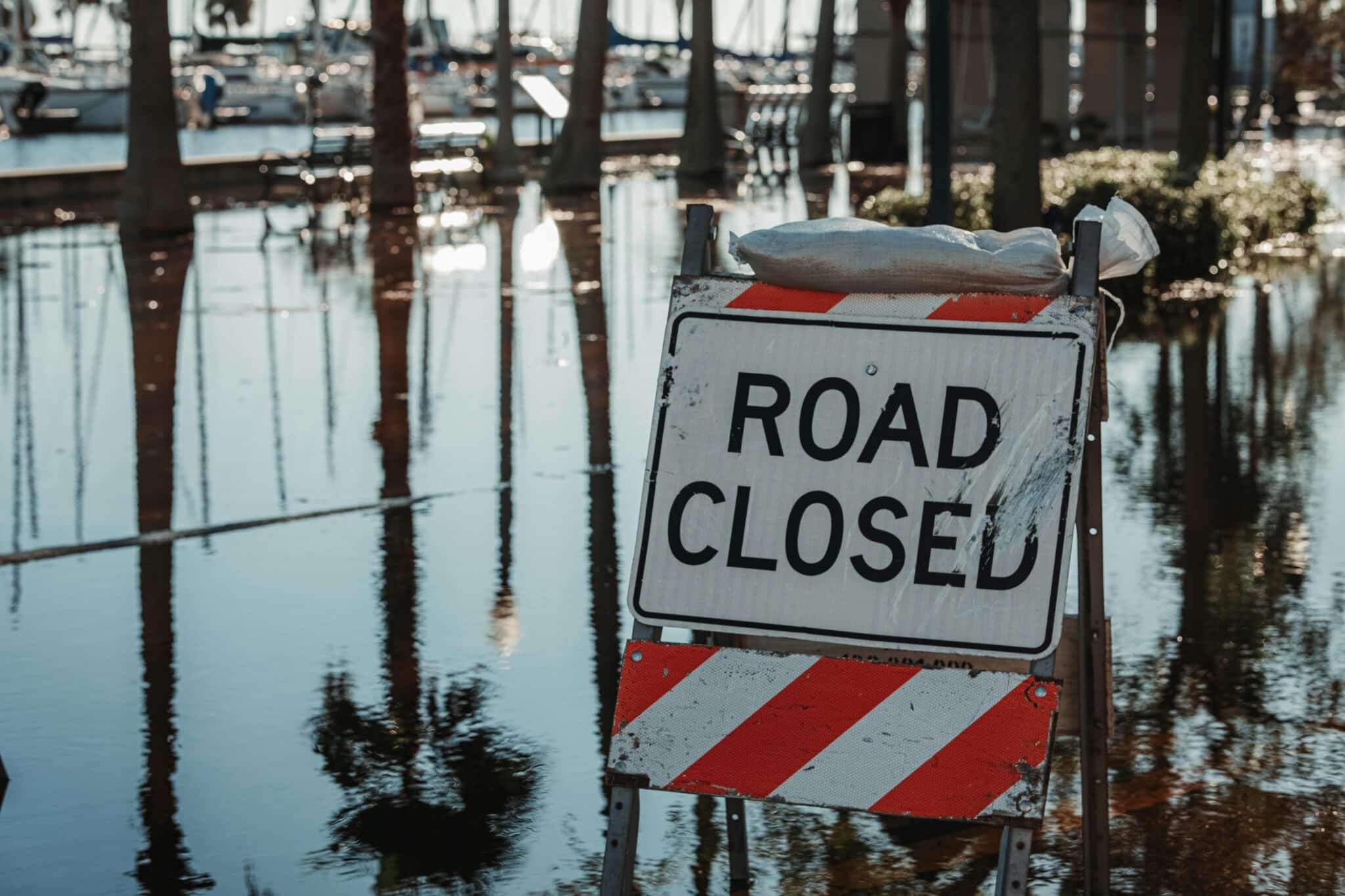
🆘 Post-Storm Safety Protocols
The danger doesn’t end when winds subside. Standing water may hide downed power lines creating electrocution hazards. Damaged structures can collapse without warning. Gas leaks pose explosion and poisoning risks.
Avoid driving unless absolutely necessary, as roads may be impassable with flooding, debris, or structural damage. Emergency vehicles need clear access, and becoming stranded diverts resources from other victims.
Document all damage thoroughly before beginning cleanup for insurance claims. Wear protective equipment including heavy gloves, sturdy boots, and eye protection when assessing or clearing debris.
Water Safety and Health Concerns
Assume all standing water is contaminated with sewage, chemicals, or other hazardous materials. Floodwaters also hide dangerous debris, submerged vehicles, and open manholes. Just six inches of moving water can knock adults off their feet.
Use only bottled, boiled, or treated water for drinking, cooking, and hygiene until authorities confirm municipal supplies are safe. Carbon monoxide poisoning kills many people after storms who operate generators, grills, or other fuel-burning devices indoors or in poorly ventilated areas.
💡 Building Long-Term Weather Awareness
Developing weather literacy transforms you from passive information receiver to active risk manager. Learn to interpret basic weather maps, understand common meteorological terms, and recognize the limitations of forecasting.
Follow reputable meteorologists who explain their reasoning rather than simply delivering forecasts. Understanding the science behind predictions helps you evaluate changing situations and make informed decisions.
Participate in community emergency drills and planning efforts. Collective preparation strengthens entire neighborhoods, creating support networks that prove invaluable during actual emergencies.
Extreme weather events are becoming more frequent and intense worldwide. Staying informed, maintaining constant awareness, and having solid preparation plans aren’t just sensible precautions—they’re essential life skills. By combining technological tools with traditional weather observation and comprehensive emergency planning, you can protect yourself and your loved ones regardless of where storms may strike. Remember that your safety depends not on luck, but on knowledge, preparation, and decisive action when danger approaches.