
Anúncios
GPS and map applications have revolutionized how we navigate the world, transforming smartphones into powerful tools that guide us through unknown streets, help us avoid traffic jams, and discover new places with just a few taps.
Gone are the days when travelers relied solely on paper maps and handwritten directions. Today’s GPS mapping applications offer real-time navigation, voice-guided directions, and intelligent routing that adapts to current road conditions. These digital companions have become indispensable for daily commuters, road trip enthusiasts, delivery drivers, and anyone exploring unfamiliar territories.
Anúncios
The evolution of GPS technology combined with sophisticated mapping software has created an ecosystem where getting lost is becoming increasingly difficult. Whether you’re searching for the nearest coffee shop, planning a cross-country adventure, or simply trying to find the fastest route home during rush hour, these applications provide solutions that were unimaginable just two decades ago.
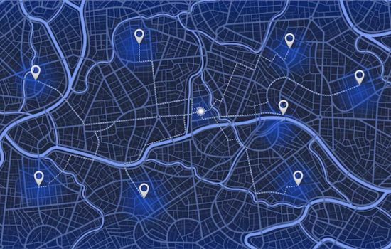
🗺️ How GPS Mapping Applications Transformed Modern Navigation
The transformation from traditional navigation methods to digital GPS mapping represents one of the most significant technological shifts in personal transportation. Before smartphones became ubiquitous, travelers depended on printed atlases, gas station directions, and sometimes pure intuition to reach their destinations.
Anúncios
Modern GPS applications leverage satellite technology, cellular data, and crowd-sourced information to provide accuracy that far surpasses older navigation systems. The Global Positioning System, originally developed for military purposes, now serves billions of civilian users worldwide through accessible smartphone applications.
These applications don’t simply show your location on a map—they analyze traffic patterns, suggest alternative routes, predict arrival times with remarkable precision, and even warn about road hazards, speed cameras, and accidents ahead. The intelligence built into these systems learns from millions of users simultaneously, creating a dynamic navigation network that improves constantly.


📱 Essential Features That Define Premium GPS Applications
Not all navigation apps are created equal. The best GPS mapping applications distinguish themselves through a combination of features that enhance both functionality and user experience.
Real-Time Traffic Updates and Intelligent Routing
The ability to receive live traffic information transforms a basic mapping tool into a strategic navigation system. Premium applications monitor road conditions continuously, identifying congestion, accidents, and construction zones. When delays are detected, the system automatically recalculates your route to avoid problem areas, potentially saving hours during your journey.
This real-time intelligence comes from multiple sources: official traffic monitoring systems, historical data analysis, and reports from other users on the road. The aggregation of these data streams creates a comprehensive picture of current driving conditions that updates every few minutes.
Offline Maps for Uninterrupted Navigation
Internet connectivity isn’t always guaranteed, especially during international travel or when exploring remote areas. Leading GPS applications allow users to download complete map sections for offline use, ensuring navigation capability regardless of cellular signal strength.
Offline functionality extends beyond basic mapping—many applications maintain turn-by-turn directions, point-of-interest databases, and even some traffic information when operating without connectivity. This feature proves invaluable for adventurers, international travelers, and anyone concerned about data usage.
Voice-Guided Directions and Hands-Free Operation
Safety regulations and common sense dictate that drivers should minimize screen interaction while operating vehicles. Voice guidance provides detailed navigation instructions without requiring visual attention, announcing upcoming turns, lane changes, and route adjustments through audio cues.
Advanced voice systems now offer natural language processing, allowing users to input destinations and adjust settings through spoken commands. This hands-free functionality significantly reduces distraction and makes navigation safer for everyone on the road.

🚗 Popular GPS Applications and Their Unique Strengths
The GPS application market offers diverse options, each with distinctive features designed for specific user needs and preferences.
Community-Driven Navigation Platforms
Some applications excel by harnessing the power of community reporting. Users actively share information about traffic conditions, police presence, road hazards, and even gas prices. This crowd-sourced model creates a collaborative navigation experience where drivers help each other navigate more efficiently and safely.
The social aspect of these platforms transforms solo driving into a connected experience. Real-time alerts from fellow travelers provide information that traditional traffic monitoring systems might miss, creating a comprehensive awareness of road conditions that benefits the entire user community.
Comprehensive Mapping with Integrated Services
Other leading applications integrate navigation with broader location services, connecting maps with local business information, reviews, photos, and reservations. These platforms function as complete travel companions, helping users not just reach destinations but also discover interesting places along the route.
The integration of satellite imagery, street-level photography, and business data creates rich contextual information that extends far beyond simple turn-by-turn directions. Users can virtually explore destinations before arriving, check operating hours, read customer reviews, and even view interior photos of restaurants and shops.
Specialized Applications for Professional Drivers
Professional drivers—including truckers, delivery personnel, and ride-share operators—require navigation tools with specialized capabilities. Dedicated applications for these users consider vehicle dimensions, weight restrictions, bridge clearances, and commercial routing regulations that standard GPS systems ignore.
These professional-grade platforms also optimize routes for multiple stops, provide detailed parking information for large vehicles, and integrate with fleet management systems for businesses coordinating numerous drivers simultaneously.
🌍 International Travel and Cross-Border Navigation
GPS mapping applications have revolutionized international travel by eliminating language barriers and geographic unfamiliarity that once made navigating foreign countries intimidating.
Modern applications support dozens of languages, automatically adjusting interface text and voice guidance based on user preferences or device settings. Map data for most countries worldwide can be downloaded before departure, ensuring navigation capability without incurring expensive international data roaming charges.
Some applications even provide country-specific features, such as information about speed camera locations in regions where they’re legal to report, local traffic regulations, and culturally relevant points of interest. This localization makes navigation in unfamiliar countries feel almost as comfortable as driving at home.
🔋 Battery Management and Resource Optimization
Continuous GPS usage, screen illumination, and data connectivity can quickly drain smartphone batteries—a significant concern during long journeys or full days of navigation.
Modern GPS applications have implemented various power-saving strategies to extend battery life. These include reducing screen brightness during navigation, limiting background data refresh when route guidance isn’t active, and optimizing GPS polling intervals to balance accuracy with power consumption.
Users can further enhance battery performance by enabling battery-saver modes within applications, downloading maps for offline use to reduce cellular data transmission, and using vehicle charging systems during extended navigation sessions. Some applications also offer “dark mode” interfaces that consume less power on devices with OLED screens.
🎯 Customization Options for Personalized Navigation
The best GPS applications recognize that drivers have different preferences, priorities, and navigation styles. Comprehensive customization options allow users to tailor the navigation experience to their specific needs.
Route preferences can be adjusted to prioritize the fastest time, shortest distance, or most fuel-efficient path. Some users prefer avoiding highways, toll roads, or ferries, while others want routes that minimize left turns or difficult intersections. Advanced applications accommodate all these preferences, calculating routes that align with individual priorities.
Visual customization extends to map display styles, with options for standard views, satellite imagery, terrain representation, and even artistic or simplified map designs. Voice guidance can be personalized through volume adjustment, verbosity levels, and sometimes even different voice options or celebrity narrations.
📊 Privacy Considerations and Location Data Security
GPS applications necessarily collect and process location data to provide navigation services, raising legitimate privacy concerns among security-conscious users.
Reputable navigation platforms implement various privacy protections, including encrypted data transmission, anonymized traffic reporting, and user controls over location history retention. Many applications allow users to delete historical location data, disable personalized features based on past travel patterns, and limit location sharing to only when the application is actively in use.
Understanding privacy policies and configuring appropriate settings helps users balance the convenience of personalized navigation features with protection of sensitive location information. Users concerned about privacy should review permission settings regularly and consider using applications that offer stronger data protection commitments.
🚀 Emerging Technologies Shaping Future Navigation
The GPS mapping application landscape continues evolving rapidly as new technologies create possibilities beyond current capabilities.
Augmented Reality Navigation
Augmented reality features overlay navigation instructions directly onto live camera views of the road ahead, creating intuitive visual guidance that’s easier to interpret than traditional map displays. Arrows and indicators appear to float above actual streets, eliminating confusion about which intersection to navigate or which lane to occupy.
This technology proves especially valuable in complex urban environments with multiple intersections, highway exchanges, and unclear signage. As AR capabilities mature and become more widespread, they’ll likely transform navigation into an even more intuitive experience.
Electric Vehicle Integration
As electric vehicles become more common, GPS applications are developing specialized features for EV drivers. These include routing that considers battery range, automatic identification of charging stations along routes, real-time charger availability information, and route optimization that accounts for charging time.
Some advanced systems even integrate with vehicle battery management systems to provide precise range predictions based on current charge levels, driving conditions, weather, and terrain—ensuring drivers never experience unexpected range anxiety.
Artificial Intelligence and Predictive Routing
Machine learning algorithms are making GPS applications increasingly intelligent, predicting likely destinations based on time, day, and historical patterns. AI-powered systems can suggest departure times to arrive at scheduled appointments despite traffic, recommend optimal parking locations near destinations, and even predict future traffic patterns with impressive accuracy.
These intelligent features transform GPS applications from reactive navigation tools into proactive travel assistants that anticipate needs and optimize journeys with minimal user input.
💡 Tips for Maximizing Your GPS Navigation Experience
Getting the most from GPS mapping applications requires understanding features and implementing smart usage practices.
- Update maps regularly: Regular updates ensure access to new roads, modified traffic patterns, and corrected business information
- Download offline maps: Prepare for poor connectivity by downloading maps for frequently traveled areas
- Explore alternative routes: Don’t blindly follow the first suggested route—review alternatives that might better suit your preferences
- Contribute to community features: Report hazards, traffic, and road issues to help other drivers and improve overall data quality
- Configure settings before driving: Adjust route preferences, map display, and voice guidance before starting your journey to avoid distracted driving
- Use voice commands: Learn voice command capabilities to minimize screen interaction while driving
- Review privacy settings: Understand and configure location data collection according to your comfort level
- Keep your device charged: Invest in quality vehicle chargers to maintain power during extended navigation sessions
🌟 Choosing the Right GPS Application for Your Needs
With numerous options available, selecting the ideal GPS application depends on individual priorities, usage patterns, and specific requirements.
Casual users who occasionally need directions might prefer simple, integrated mapping tools that come pre-installed on smartphones. These applications offer solid basic functionality without requiring additional downloads or account creation.
Daily commuters benefit from applications with superior real-time traffic intelligence and community reporting, helping them avoid delays and discover the fastest routes during rush hour. The time savings from consistent traffic avoidance can be substantial over months and years of regular commuting.
Frequent travelers need robust offline capabilities, international coverage, and comprehensive point-of-interest databases that work seamlessly across borders. Applications with strong international support and cultural localization make exploring foreign countries significantly less stressful.
Professional drivers require specialized features that accommodate commercial vehicles, optimize multi-stop routes, and integrate with business systems. Investing in professional-grade navigation tools pays dividends through improved efficiency and reduced operational complications.
🔧 Troubleshooting Common GPS Navigation Issues
Even the best GPS applications occasionally encounter problems that affect navigation quality.
Poor GPS accuracy often results from environmental factors like tall buildings, heavy tree cover, or adverse weather conditions that interfere with satellite signals. Moving to more open areas typically resolves these issues. Ensure location services are enabled in device settings and that the application has necessary permissions.
Outdated map data can cause routing errors or incorrect business information. Regular application updates usually include map refreshes, but users can often manually trigger map downloads to ensure current data.
Battery drain during navigation can be mitigated through power-saving settings, reduced screen brightness, offline map usage, and reliable vehicle charging solutions. Some devices also benefit from closing unnecessary background applications that consume resources.
Connectivity issues affecting traffic updates and online features may require troubleshooting mobile data settings or switching between cellular and Wi-Fi networks when available.
🎉 The Indispensable Role of GPS in Modern Life
GPS mapping applications have evolved from convenient luxuries into essential utilities that billions of people rely upon daily. They’ve transformed how we explore cities, enabled new business models like ride-sharing and delivery services, and made travel accessible to people who once found navigation intimidating.
The continuous innovation in this space promises even more impressive capabilities in coming years. As artificial intelligence, augmented reality, and connectivity technologies advance, navigation will become increasingly seamless, intuitive, and integrated with broader aspects of daily life.
Whether you’re commuting to work, exploring a new city, embarking on a road trip adventure, or simply finding the nearest grocery store, GPS mapping applications provide guidance that’s accurate, intelligent, and remarkably easy to use. These digital navigators have fundamentally changed our relationship with geography, making the world more accessible and less intimidating for everyone with a smartphone.
The choice of which application to use ultimately depends on your specific needs, preferences, and usage patterns. Experimenting with different options helps identify which platform offers the features and interface that best complement your navigation style. Regardless of which application you choose, you’re benefiting from decades of technological advancement that have made getting lost increasingly difficult and discovering new places easier than ever before.